Segment VI
Québec Bikepacking Traverse
215 kilometers
2 002 mètres de dénivelé positif
9,3 m / km
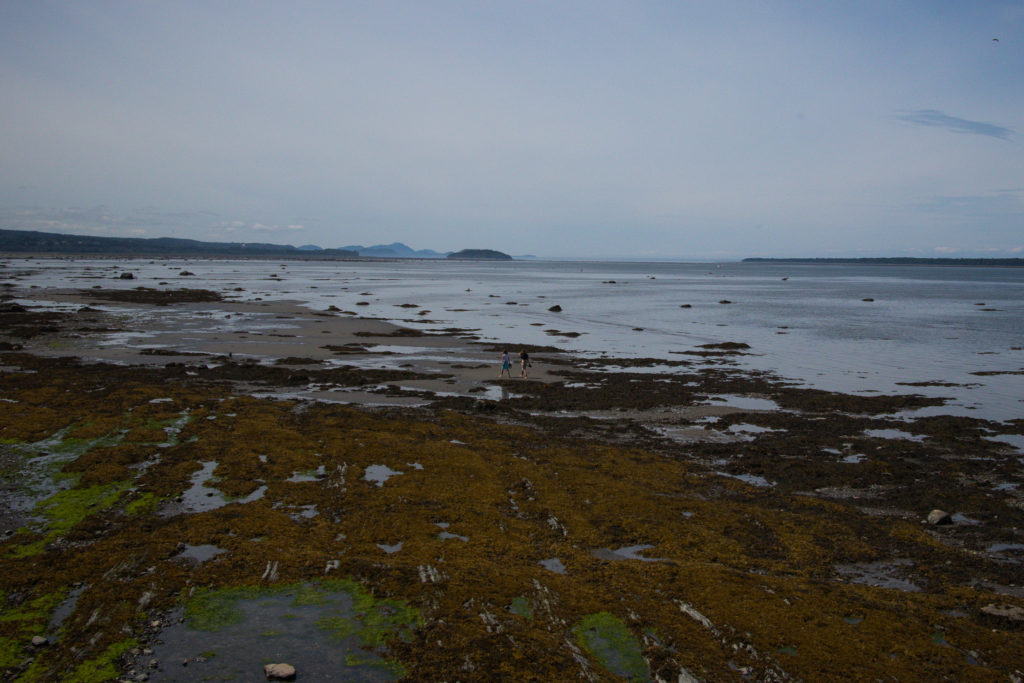
Parc national du Bic
Parc national du Lac-Témiscouata
Connect with:
Rimouski - Appalaches Shortcut
Charlevoix - Rivière-du-Loup Shortcut
External links:
Navette fluviale l’Épinoche du parc national du Lac-Témiscouata
BAS-SAINT-LAURENT
Rimouski – Parc national du Lac-Témiscouata
Welcome on the St. Lawrence Southern shore!
Le segment VI du Québec Bikepacking Traverse diffère beaucoup des autres par sa proximité à la colonne vertébrale du Québec, le catalyseur du développement économique, culturel et social de cette nation : le fleuve Saint-Laurent. Ce fleuve, c’est le personnage principale de l’histoire du Québec. Ce fût l’immense voie de communication des Amérindiens, ce fût la porte d’entrée des explorateurs européens, et c’est maintenant la voie de sortie sur le monde, essentiel à notre commerce.
Sur ce segment, on perd l’orientation vers l’est du QcBT, remontant ici le fleuve vers le sud-ouest. Ce détour en vaut la peine, pour apprécier le décor marin enchanteur du fleuve. Quelques kilomètres après être sorti de la ville de Rimouski, le parcours entre dans le populaire Bic national park, où l’on trouve un concentré de cabourons, ces petites collines typiques de la région. La route le long du fleuve n’est pas plate, car de nombreuses échines doivent être surmontés, tels des plissements des Appalaches avant de toucher le fleuve. À Rivière-du-Loup, l’itinéraire quitte le fleuve et s’élance sur le Petit-Temis, une piste cyclable en poussière de pierre qui emprunte le lit d’une ancienne voie ferrée traversant les Appalaches. Celle-ci nous amènera jusqu’au lac Témiscouata, où il faudra emprunter une navette maritime du Lac-Témiscouata national park pour traverser le plan d’eau dominant le centre d’une longue vallée d’origine glaciaire.
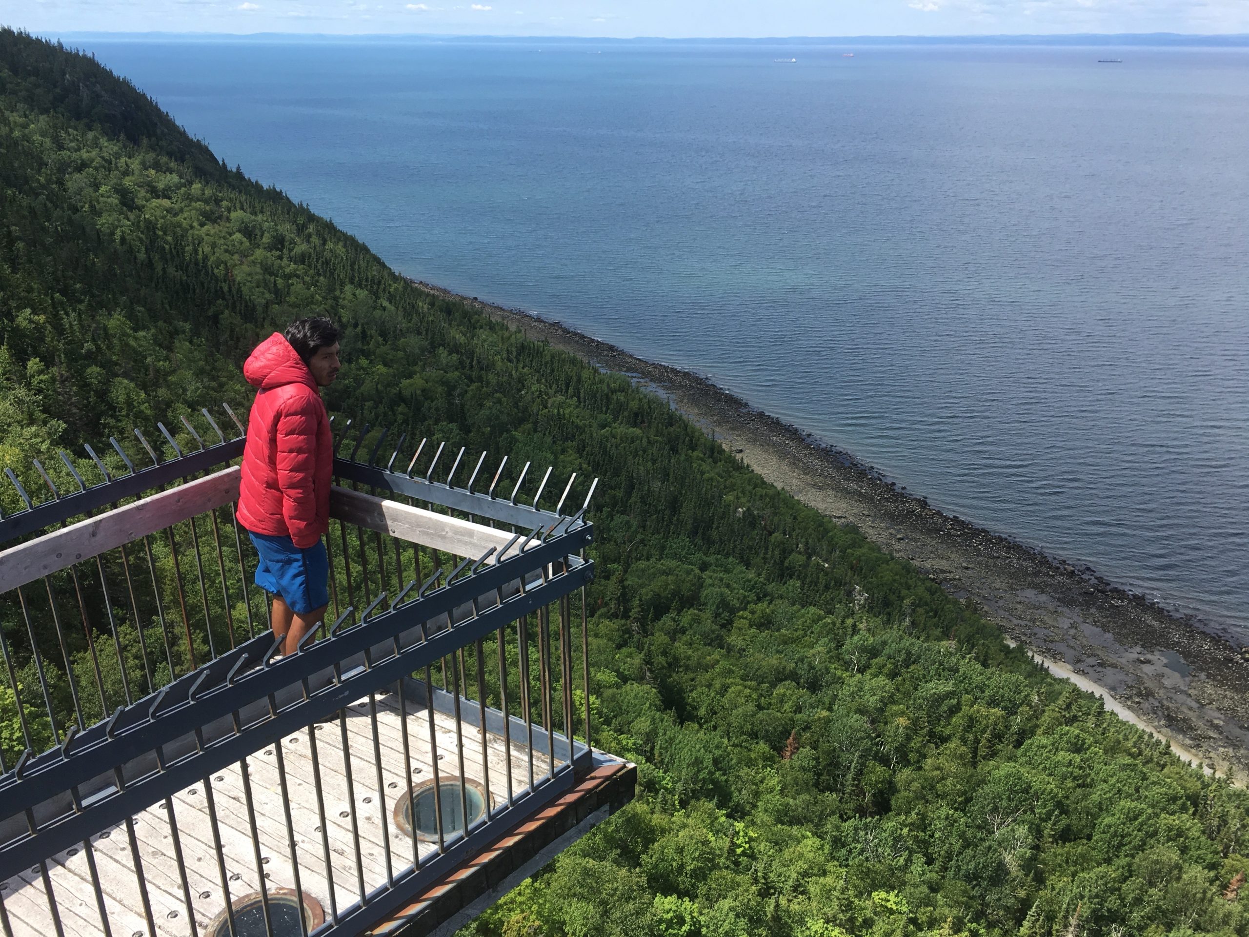
This segment borrow part of Route Verte. Bien qu’au relief ondulé le long du fleuve, le segment VI est l’un des plus facile à parcourir, entre autre car il s’agit du segment qui a la plus forte proportion de routes et pistes cyclables pavées. On ne circule tout de même que très peu sur la 132, la route principale. La piste du Littoral Basque, longeant le fleuve, parfois en forêt et en hauteur, saura impressionner. Le dernier tiers du segment sur l’ancienne voie ferrée garantit également une pente ne dépassant jamais 4%. Il est possible de sauter ce segment au complet ou en partie en empruntant soit le Rimouski - Appalaches Shortcutor the Charlevoix – Rivière-du-Loup Shortcut. However, it promises a definitely distinct landscape than the rest of the QcBT.
Merci à Marie-Pier Savard pour ses photos


Ideas
Comments
Recommandations
Terms of use : As with each route published on bikepacking.quebec, should you choose to cycle this route, or use any other means of transportation, do so at your own risk. The creators of bikepacking.quebec, its partners, associates, and contributors are in no way liable for personal injury, damage to personal property, or any other such situation that might happen to individuals following this route. The information found herein is a planning and inspiration resource. Despite the fact that the information on this page, as well as the associated map and GPS track (GPX and maps), were researched, prepared and published diligently, the accuracy of those informations is not guaranteed. Before leaving, check current local weather as well as roads and paths conditions and potential closures. While riding, obey all public authorities instructions and restrictions, respect private land, carry first aid, repairs and navigational equipment, respect the environment, and of course, use common sense.