Segment VI
Québec Bikepacking Traverse
215 kilometers
2 002 mètres de dénivelé positif
9,3 m / km
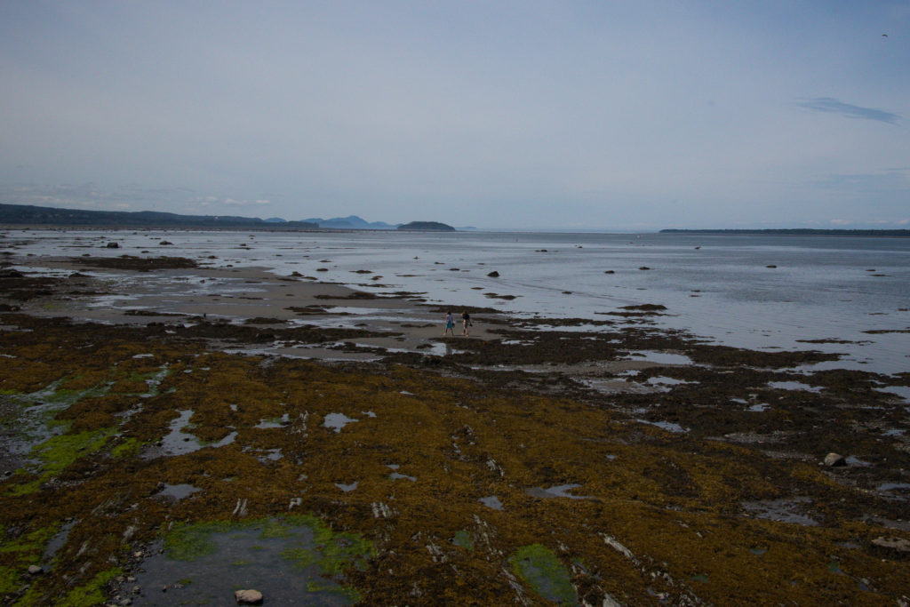
Parc national du Bic
Parc national du Lac-Témiscouata
Connect with:
Rimouski - Appalaches Shortcut
Charlevoix - Rivière-du-Loup Shortcut
External links:
Ferry shuttle l’Épinoche from parc national du Lac-Témiscouata
BAS-SAINT-LAURENT
Rimouski – Parc national du Lac-Témiscouata
Welcome on the St. Lawrence Southern shore!
The segment VI of the Québec Bikepacking Traverse differs quite a lot from the other segments by its proximity to Quebec's backbone, the catalyst of economical, cultural and social development of this nation: the Saint Lawrence River. In French, we say "fleuve", which has a higher hierarchy than "rivière", because it reaches the ocean. This "fleuve" is the main character of Quebec. It was the gigantic way of communication of the Natives, it was the front door of European explorers and it's now the exit door to the world, essential to our commerce.
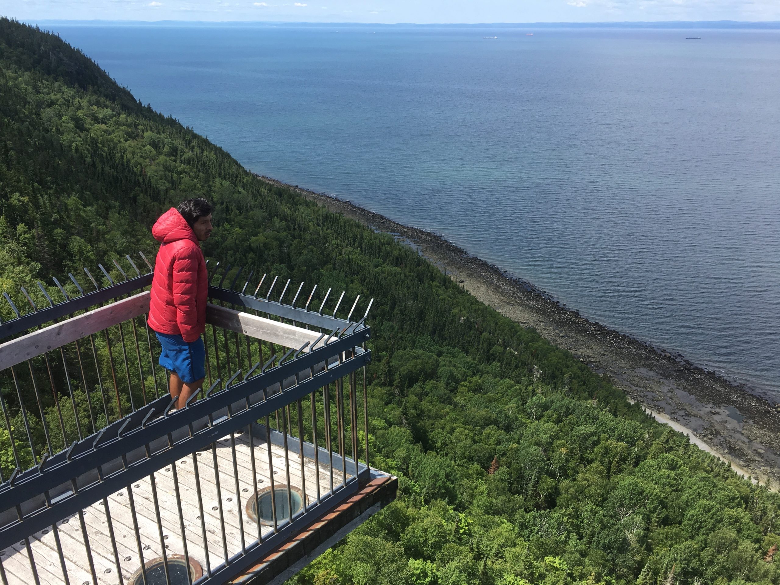
On this segment, we loose the eastward orientation of the QcBT, going upriver toward the Southwest. This detour is worthy, in order to appreciate the enchanting marine sights of the river. A few kilometers after leaving the city of Rimouski, the route enters the popular Bic national park, where we can find a concentration of small rounded hills typical to the region. The road along the St. Lawrence isn't flat, as those rocky hills with a steep northern slope and a relatively gentle southern slope needs to be overcome, like Appalachian folds reaching the St. Lawrence. At Rivière-du-Loup, the route leaves the river and embark on the Petit-Temis, an unpaved bikepath that sits on a former train track crossing the Appalachians. This path will bring us to Temiscouata Lake, where there is a small ferry shuttle from the Lac-Témiscouata national park to cross the lake dominating a long glaciation-origin valley.
This segment borrow part of Route Verteroute 1 and 6. Even though with a wavy profile along the St Lawrence, segment VI is one of the easiest to travel, because amongst other things it has the highest proportion of paved roads and bike paths. We don't ride a lot on "la 132", the main road. The Littoral Basque pathway, running alongside the "fleuve", sometimes in forest and in heights, will impress. The segment's last tier on the former train track also guarantee a slope never going over 4%. It is possible to jump this segment, fully or in part, by taking either the Rimouski - Appalaches Shortcutor the Charlevoix – Rivière-du-Loup Shortcut. However, it promises a definitely distinct landscape than the rest of the QcBT.
Merci à Marie-Pier Savard pour ses photos


Ideas
Comments
Recommandations
Terms of use : As with each route published on bikepacking.quebec, should you choose to cycle this route, or use any other means of transportation, do so at your own risk. The creators of bikepacking.quebec, its partners, associates, and contributors are in no way liable for personal injury, damage to personal property, or any other such situation that might happen to individuals following this route. The information found herein is a planning and inspiration resource. Despite the fact that the information on this page, as well as the associated map and GPS track (GPX and maps), were researched, prepared and published diligently, the accuracy of those informations is not guaranteed. Before leaving, check current local weather as well as roads and paths conditions and potential closures. While riding, obey all public authorities instructions and restrictions, respect private land, carry first aid, repairs and navigational equipment, respect the environment, and of course, use common sense.