Différentes manières de tirer avantage des cartes du site
Les itinéraires présentés ce site sont construits à l’aide de Ride with GPS (RwGPS), qui en plus de la planification d’itinéraires (routes), permet aussi d’enregistrer ses randonnées (rides). La planification d’itinéraires permet d’insérer des icônes, de changer les couleurs du tracé (fonction utilisée dans notre cas pour le type de surface) et d’intégrer les cartes sur le site de bikepacking.quebec avec un visuel intéressant.
Les cartes des sections aperçu général, autant du tracé principal du Québec Bikepacking Traverse que du réseau d’itinéraires, sont construites avec My Maps de Google, en y important les fichiers GPS créés avec RwGPS. Certains pourraient être tentés de copier ces cartes générales sur leur propre compte Google ou télécharger le fichier .kml pour l’utiliser dans leur appareil. Il est toutefois conseillé de télécharger les différents itinéraires proposé sur le site directement via RwGPS car:
- le fichier d’un itinéraire moins long est plus facile à charger sur votre appareil et aura moins tendance à boguer;
- les itinéraires sur RwGPS sont fréquemment améliorés et la mise à jour sur la carte d’aperçu général peut prendre plus de temps à être faite.
Pas besoin d’utiliser les options payantes de RwGPS pour profiter des fonctionnalités permettant d’enregistrer les itinéraires sur son appareil. Créer un compte gratuit est simple et rapide avec un courriel et un mot de passe.
Utiliser les itinéraires sur son GPS
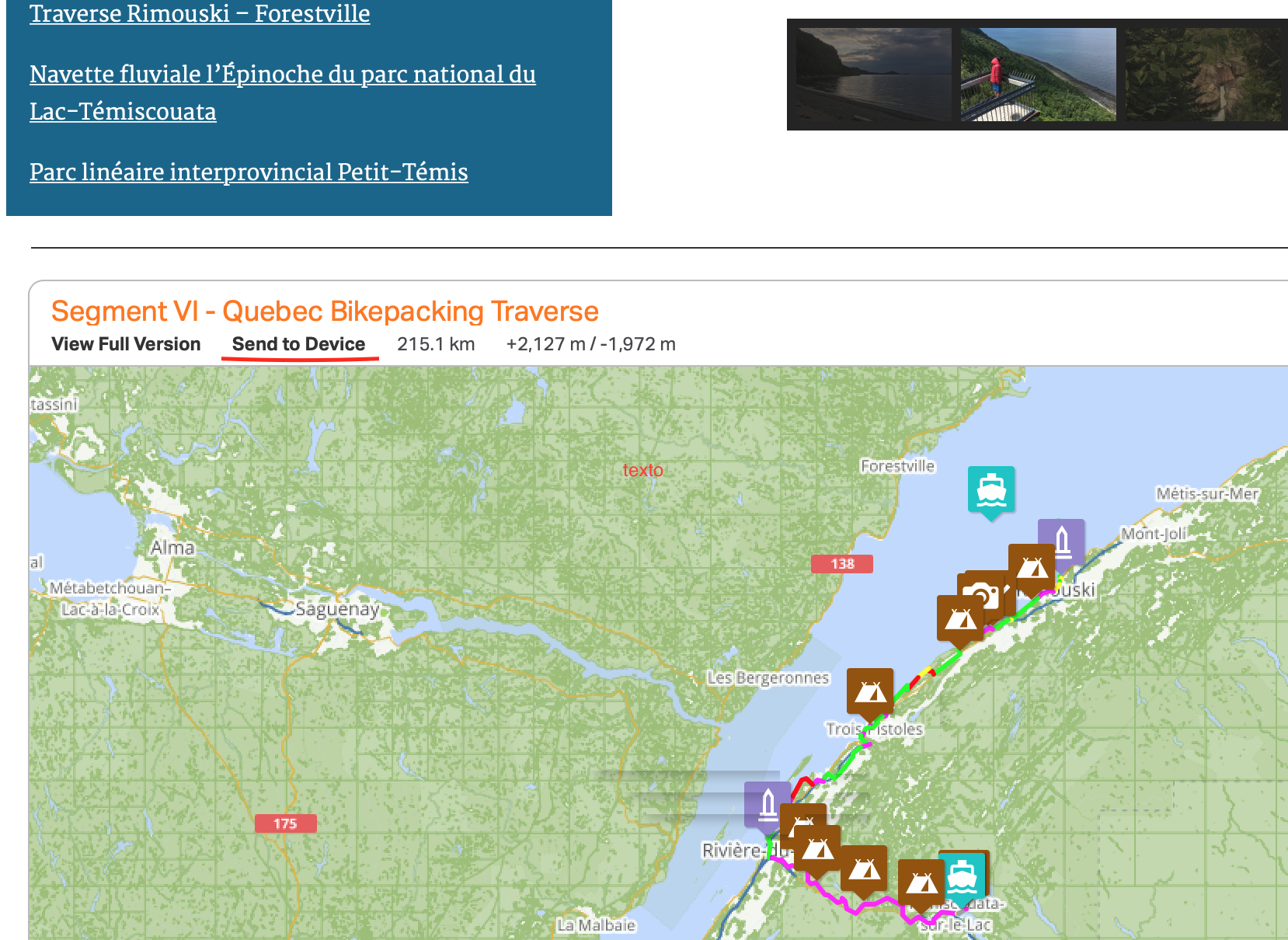
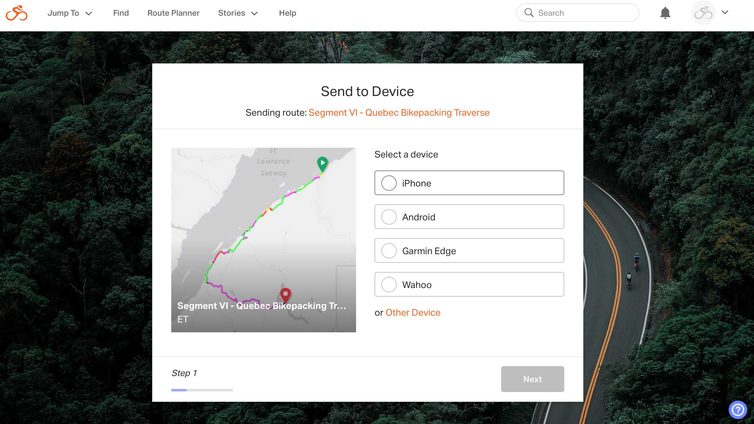
Tout d’abord, allez sur la page du site de bikepacking.quebec de l’itinéraire que vous voulez enregistrer et trouvez la carte. Cliquez sur Send to Device.
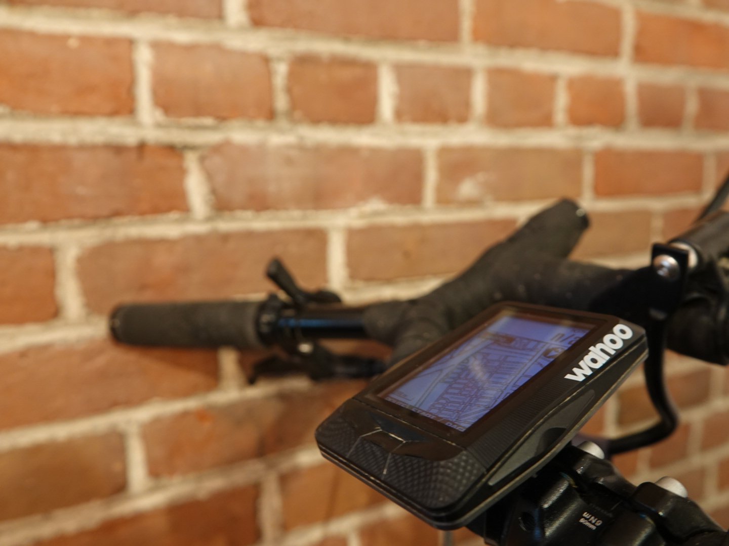
Si vous avez un Wahoo, vous aurez besoin des applications de RwGPS et de Wahoo sur votre téléphone. Suivez les instructions à l’écran et assurez vous que votre téléphone a le Bluetooth et wifi activé. En cliquant sur l’option Wahoo, l’itinéraire sera épinglé (pinned) sur votre propre compte RwGPS, et se retrouvera dans vos favoris lors de la prochaine synchronisation de votre GPS avec l’application Wahoo.
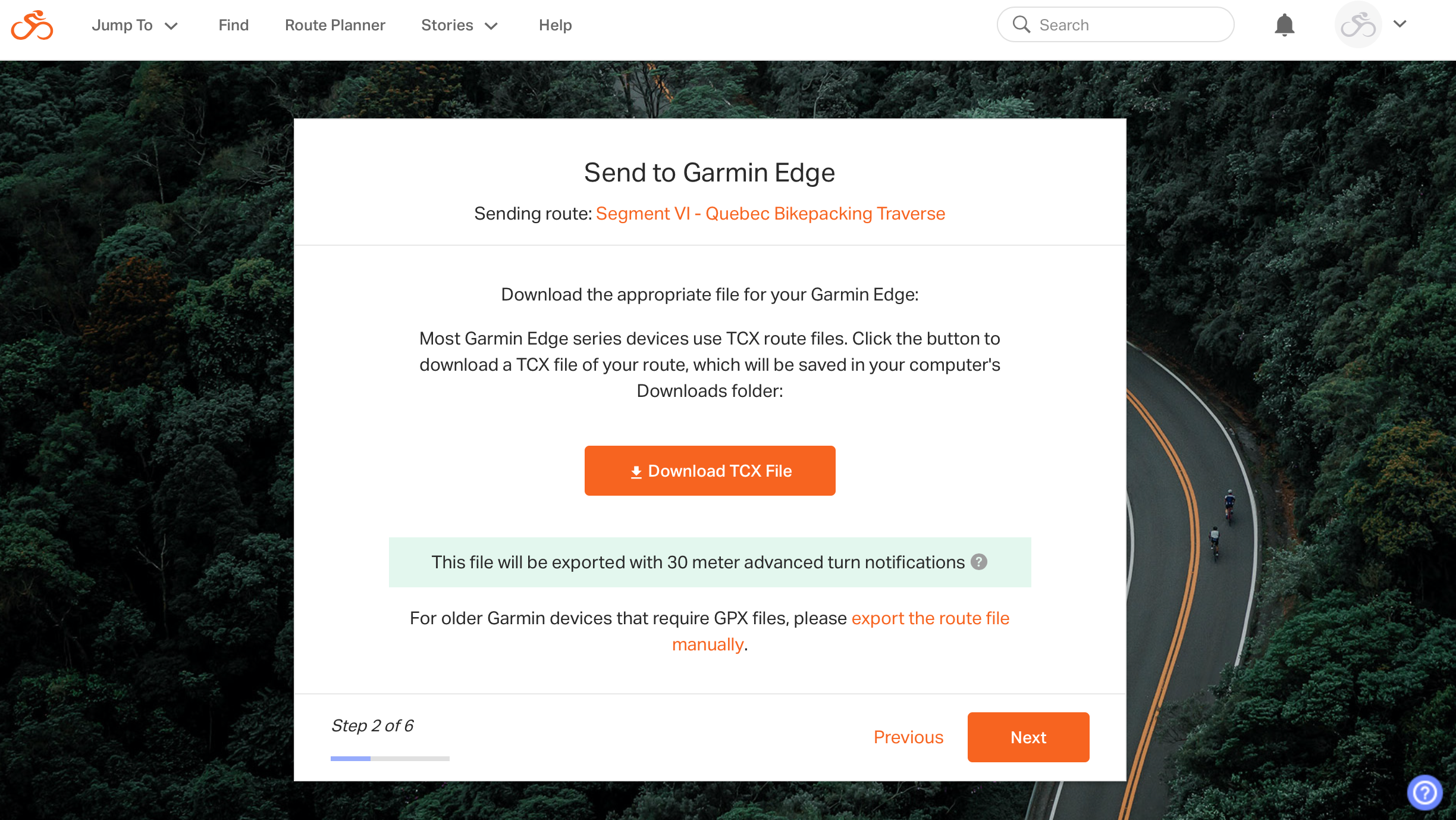
Les GPS Garmin utilisent les fichiers .fit ou .tcx et le site de RwGPS vous invitera à télécharger ce dernier format sur votre ordinateur. Branchez votre GPS à votre ordinateur pour enregistrer l’itinéraire en suivant les instructions à l’écran.
Utiliser les itinéraires sur son téléphone
En cliquant sur le même lien Send to Device, vous pouvez envoyer l’itinéraire sur votre iPhone ou appareil Android. Dans les deux cas, vous devez avoir l’application de RwGPS sur votre téléphone. Après y avoir envoyé l’itinéraire, vous serez invité à le télécharger, ce qui permettra l’utilisation de la carte en mode hors ligne. Vous pouvez ensuite naviguer l’itinéraire même si vous n’êtes pas sur votre réseau cellulaire.
Utiliser d’autres applications
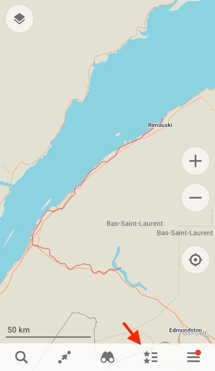
Naviguer un fichier GPS sur son téléphone peut épuiser la batterie rapidement. Si vous désirez seulement avoir une vue d’ensemble de l’itinéraire sur votre téléphone, comme complément (ou non) de l’utilisation d’un GPS, il est possible de le faire, en utilisant une application comme maps.me. Cette application permet de télécharger les cartes d’une région pour ensuite pouvoir les utiliser hors ligne.
Sur la carte affichée sur le site de bikepacking.quebec, cliquer sur View Full Version, juste à côté de Send to Device. Vous serez dirigé vers l’itinéraire directement sur le site de RwGPS. En cliquant sur More puis Export as File, un menu s’ouvrira avec plusieurs types de fichiers possibles à télécharger. Il est possible de faire ceci sans créer de compte sur RwGPS.


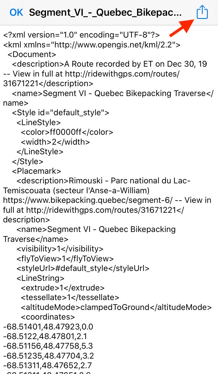
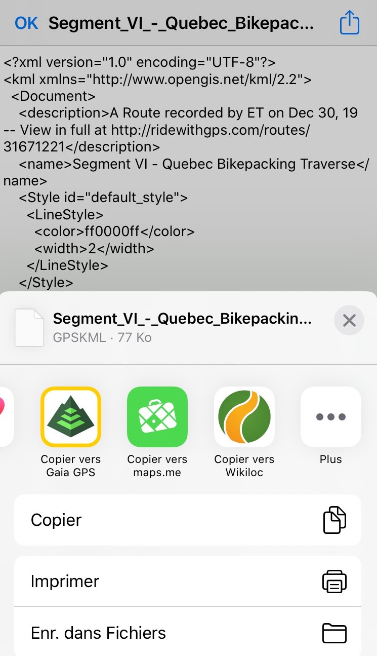
Le format .kml est celui utilisé pour présenter des tracés sur une carte Google, mais sont aussi utiles pour maps.me. Téléchargez ce format, puis envoyez vous les par courriel. Sur votre téléphone, en ouvrant le fichier joint, vous n’y verrez que du code, mais en appuyant sur l’icône partage, vous pourrez envoyer le fichier vers maps.me ou votre application de cartographie préférée. Dans maps.me, les fichiers enregistrés se retrouveront dans l’onglet signets, et vous pouvez les rendre visible ou non, ainsi qu’ajouter des points repères.
Finalement, lorsque vous utilisez une application pour vous géolocaliser alors que vous n’avez pas de service cellulaire ou que vous êtes en mode avion, n’oubliez pas de garder le wifi actif afin de pouvoir vous localiser avec plus de précision.
Et vous, quels outils de navigation utilisez-vous lors de vos aventures de bikepacking?
Stevie Souvenir says:
Respect énorme à tous ceux qui ont collaboré sur le projet. Je trouve ca encourageant de pouvoir voyager au Québec en toute sécurité sans crainte de se faire frapper par un véhicule. C’était un rêve pour moi de traverser le Qc en vélo, je sens que ce jour est proche.
Bikepacking Québec says:
Merci Stevie! C’est vrai que c’est encourageant de savoir que tel itinéraire peut exister ici! Bien qu’il y a généralement peu de traffic sur ces routes, il peut tout de même y avoir des véhicules qui passent, généralement peu habitués à voir des cyclistes dans la forêt! Il faut donc rester vigilant! Le projet prend forme et en espérant que 2021 soit l’année où l’itinéraire complet sera vérifié!